Regional Flavor Map
Cartographiez l'évolution des saveurs dans une région — plats, ingrédients et techniques, zone par zone.
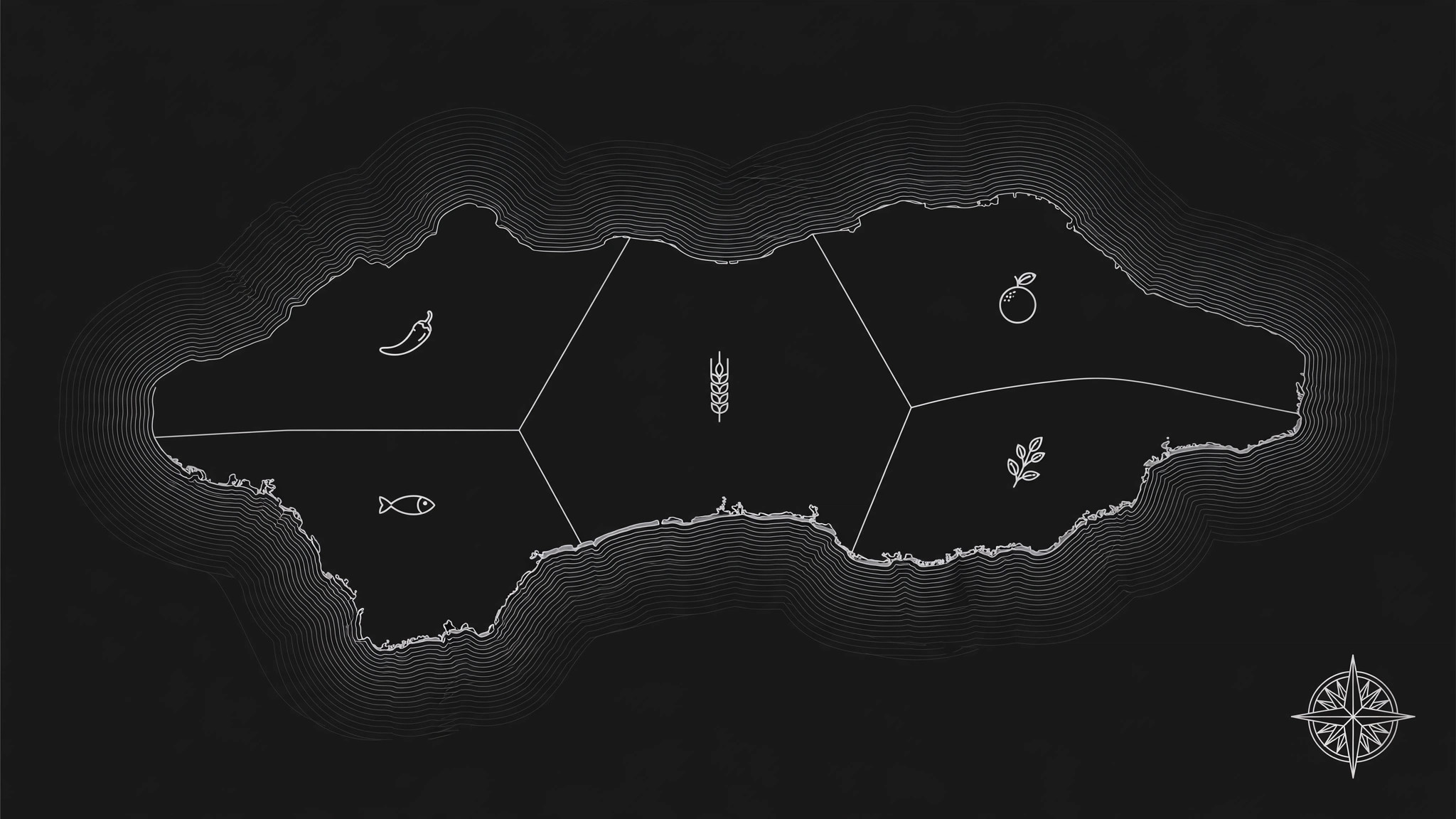
Transforme votre IA en cartographe de la culture culinaire — elle recueille les plats signatures, les ingrédients et les techniques de cuisson d'une région, les organise par géographie et produit une carte des saveurs illustrée qui montre comment les goûts changent d'un lieu à l'autre.
Installez-la en 3 étapes
Sans inscription. Sans outils en ligne de commande. Choisissez votre IA, copiez une ligne, collez-la.
Vous préférez le faire vous-même ? Achetez la compétence ($4.99), téléchargez le ZIP depuis votre confirmation d'achat, décompressez-le dans le répertoire indiqué ci-dessus, redémarrez votre session IA — même résultat. Vous l'avez déjà achetée ? Votre assistant IA peut la télécharger pour vous.
Contenu du pack
Un fichier SKILL.md (le guide pratique) + un modèle de départ. Aperçu :
Regional Flavor Map
When to use
- You run a food publication, travel guide, or restaurant brand and want a visual that explains a region's cuisine at a glance
- You're planning a food trip and want to know what to eat where, instead of a generic "best restaurants" list
- A tourism board, market, or food festival needs a poster or web graphic that makes local food culture legible to visitors
- You're writing a cookbook chapter on a region and need a map that ties dishes to the places that made them
- A classroom or museum exhibit needs a one-page visual showing how geography shapes what people eat
Workflow
- Define the region and its boundaries (input: region name + scope → output: map scope sheet)
Pick the region and draw its borders honestly: a province, a city and its surroundings, a river valley, a coastline. Decide the granularity up front — a country-level map shows broad zones; a city map can show neighborhoods and markets. Write down what counts as "in" and what's excluded, because a flavor map that tries to cover everything ends up saying nothing. This scope sheet is the contract for every later step. - Gather dishes, ingredients, and techniques (input: scope sheet + research → output: dish inventory)
For each sub-area inside the region, collect: 3–8 signature dishes, the staple ingredients grown or traded there, and 1–2 defining techniques (smoking, fermenting, wok-frying, slow braising). Record a one-line origin note per dish — why it exists here (coastline fish, mountain herbs, trade-route spices, cold-climate preservation). Prefer dishes locals actually eat over dishes tourists photograph; if a dish is famous but rarely eaten at home, flag it as a showcase dish rather than a staple. - Find the geographic logic (input: dish inventory → output: flavor zones)
Group the inventory into zones that a reader can see on the map: coastal vs. inland, highland vs. lowland, north vs. south, or along a river or trade route. Each zone gets a flavor profile in plain words — "salty, sour, chili heat" or "buttery, mild, herb-forward" — plus its 2–3 most representative dishes. If two neighboring zones look identical on paper, merge them; a map with twelve indistinguishable zones is a list wearing a map costume. - Draft the map layout (input: flavor zones → output: map draft)
Place each zone on the map with its dishes, ingredients, and a small icon per zone. Keep labels short (dish name + one flavor word), keep the legend to one corner, and leave breathing room — a crowded map gets ignored. Put the most surprising zone (the one that breaks outsiders' assumptions) in the visual center or give it the strongest contrast, so the map teaches something instead of confirming clichés. - Verify and polish (input: map draft → output: finished flavor map)
Check every dish against its zone: is it really from there, or did it migrate? Confirm spellings of dish names and place names, and have someone who knows the region read the draft — they will catch the one error that would sink your credibility. Then finalize colors, typography, and export: print resolution for posters, web resolution plus alt text for online use.
Aperçu du modèle
Regional Flavor Map — Template
One region = one map. Fill this in before any drawing starts.
Map scope
Region: {name} | Boundaries: {what's in / what's out} | Granularity: {country / province / city / neighborhood}
Intended use: {poster / web graphic / cookbook chapter / classroom handout} Audience: {tourists / locals / students / readers}
Dish inventory
Showcase vs. staple: {dishes famous with tourists but rarely eaten at home — flag them}
Flavor zones (3–7)
Zone 1: {name — e.g. Coastal}
- Flavor profile: {plain words: salty, sour, chili heat…}
- Representative dishes: {2–3 dishes}
Le pack de compétence lui-même (SKILL.md + modèle) est rédigé en anglais.
Vous aimerez aussi
 Images
Social Cover
Des couvertures de publication avec 3 recettes de composition — prêtes à l'emploi
 Images
Infographic
Transformez un paragraphe en une image — sans jamais inventer de données
 Images
Product Poster
Affiches e-commerce : arguments de vente, ancrage prix et appel à l'action en une fois